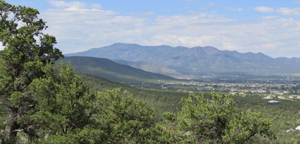
Sangre de Cristo Mountains, southernmost subrange of the Rocky Mountains.

Sangre de Cristo Mountains, southernmost subrange of the Rocky Mountains.
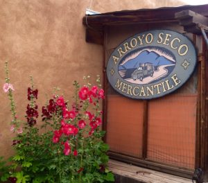
One sunny afternoon I drove to one of my favorite villages in Northern New Mexico, Arroyo Seco (known as Seco by the locals) to photograph the town for this blog post. Seco is located approximately seven miles north of Taos, New Mexico, and sits below Taos Mountain. On October 7, 1745, the town’s inhabitants acquired the rights to the lands under a grant by Joaquín Codallos y Rabal. However, as a site, it was first deeded in 1716 to General Pedro Lucero de Godoy by the Viceroy of Mexico, but the general never settled on the land.
 Settlement of the surrounding area began in 1804 when two brothers, Cristóbal Martínez and José Gregorio Martínez, planted crops in the region and built homes. According to the Spanish Archives of New Mexico, in 1815 more people began to cultivate the lands in Seco area, irrigating their crops from the Arroyo Seco Creek and the Rio Lucero.
After wandering the quaint village with its eateries and small specialty shops, many exhibiting work by local artists and craftspeople, I headed to the Church of the Most Holy Trinity. 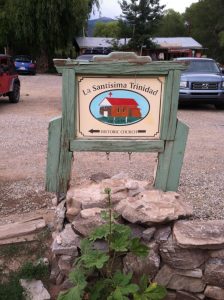 Completed in 1834, the original building had a flat roof and a dirt floor. A pitched roof and wooden floor were added in 1915, and the graves buried beneath the dirt floor were repatriated to the churchyard cemetery. The adobe structure has five-foot-thick walls at the base that taper off to three feet at the top. The ceiling has rough, flat, heavy pine vigas that rest on hand-carved wooden corbels. I snapped the photos I wanted and left the church to stroll the village, photographing my surroundings and relaxing in the small-town atmosphere.
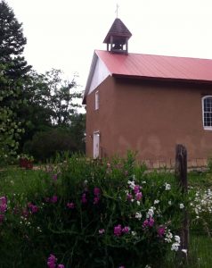
I’ve never been starstruck, but some folks are, so keep your eyes open. Among the locals and tourists you might spot a well-known politician or a famous celebrity, as some do call Northern New Mexico (when they are here) home. If you visit, do attend Seco’s Fourth of July parade, an annual event that draws throngs of happy celebrants. You can view the celebration on YouTube. The video was shot and edited by Rick Romancito of The Taos News. http://www.youtube.com/watch?v=vgkDARTbkkQ.
Rio Grande Gorge Bridge
Known by the locals as simply the “Gorge Bridge” or “High Bridge,” the three-span steel continuous-deck-truss structure with a concrete-filled steel grid deck, is a high-arch bridge that spans the Rio Grande Gorge. Many sources have the bridge ranging in height from 600 to 700 feet above the gorge floor, but its true height is 565 feet. It is the seventh highest in the United States and eighty-second highest in the world. The foot span is 600 feet, and it was built between 1963 and 1965.
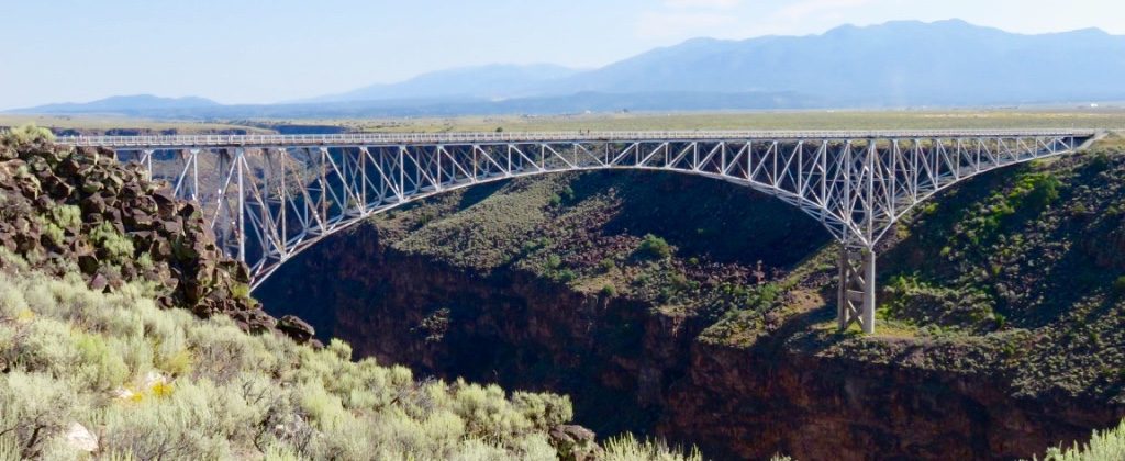
Rio Grande Bridge over the Rio Grande Gorge
The bridge has several platforms that cantilever out over the gorge, allowing pedestrians to stand several feet into space while capturing breathtaking views of the river below. If you are squeamish about heights, you should skip these platforms. The bridge also has sidewalks on both sides and low railings to make you feel somewhat secure, but if you are not keen on heights period, then you won’t care for the undulating sensation beneath your feet as vehicle after vehicle, especially big rigs, crosses the bridge. Note there is nothing between you and an almost six-hundred-foot drop except a chest-high guardrail, which brings me to . . .
 Unfortunately, the popularity of the bridge has also made it a suicide magnet. There have been more than 115 suicides in a twenty-year span, with the most recent occurring in the past two months. After years of inaction on suicide prevention, crisis phones were installed at the bridge in late 2014. The ten call boxes each bear a sign that reads, “There is hope. Make the call.” When a person presses the call button, he or she is connected to the New Mexico Crisis and Access Line in Albuquerque where counselors field the calls around the clock. Mental health advocates says it is a first step but not a prevention strategy unto itself. The New Mexico Department of Transportation is studying the feasibility of either raising the bridge railings or installing netting. The most famous example of crisis phones being installed (in 1993) was at the Golden Gate Bridge in San Francisco. In the fourteen years following their installation, 380 people leaped to their deaths from the landmark.
During a roadside chat—or call it a bridge-side chat—with a long-time Taoseño, he commented about the locals referring to the bridge as the “bridge to nowhere,” because while it was being built funding did not even exist to continue Highway 64 on the other side of the gorge. But by the time the bridge was dedicated in 1965, not only had funding been approved, but also US Route 64 was in operation as a major east-west highway.
After you walk the bridge and/or hike the state park area along the gorge, take a beverage break and enjoy the stunning views.