Rio Grande Valley
Rio Grande Valley
The Rio Grande Valley has been inhabited at least since the Archaic period, as shown by petroglyphs on exposed rock surfaces and the remains of stone tools quarried in the mountains. San Antonio Mountain was a significant source of dacite (an igneous, volcanic rock) for tools. In historic times the Jicarilla Apache and Ute Indians, as well as the peoples of Taos Pueblo and Picuris Pueblo, have inhabited the area.
Rio Grande River
Rio Grande River
The Rio Grande River begins at the base of Canby Mountain in the San Juan Mountains of Colorado. The rugged and high San Juan range is in the Rocky Mountains and is the largest, in terms of area, in Colorado. The mountain’s elevation 13,478 feet, and it sits on the Continental Divide. Water to the north and west of Canby drains to the Pacific Ocean, while water to the south and east finds its way to the Atlantic Ocean. From the base of Canby Mountain, the Rio Grande River flows 1,900 miles to the Gulf of Mexico. For more than 1,000 miles, the river serves as the international boundary between the United States and Mexico. It also defines the southern boundary of Big Bend National Park in southwestern Texas. The 118 miles of twisting waterway travels southeasterly, then abruptly changes courses to the northeast, forming the “big bend” of the Rio Grande. As it flows southward, its waters are diverted for flood control, irrigation, power generation, municipal uses, and recreation. By the time the river leaves El Paso, so much water has been diverted that the riverbed between El Paso and Presidio, Texas, often lies dry.
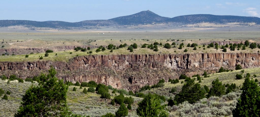
Rio Grande Rift
Rio Grande Rift
The Rio Grande Rift is an area of approximately 160,000 square miles that extends from central Colorado to Big Bend National Park. Part of this rift system is the Rio Grande Gorge, through which the river flows, and on the high mesa above the river is Taos Plateau, a rift valley, defined as a crack in the earth’s crust forged by faulting and other volcanic movement.
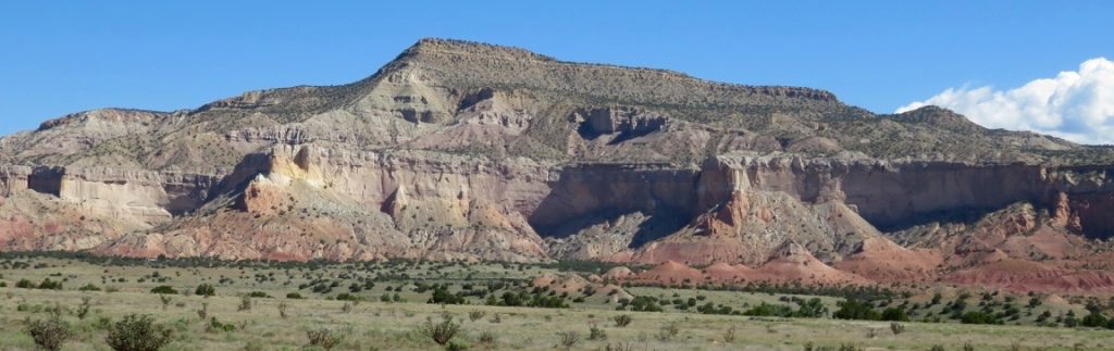
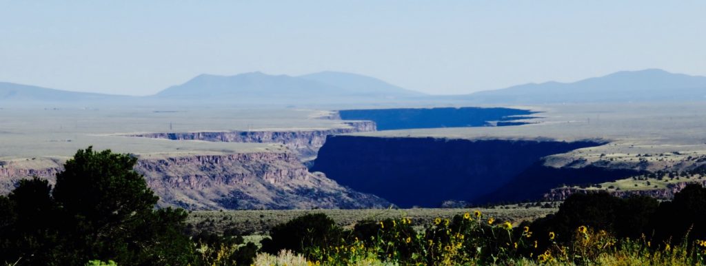
Rio Grande RiftOne of the best spots to view the Rio Grande Rift is a pullout called the Taos Valley Overlook located on Highway 68, the main road into Taos. The pullout has spectacular views of the Taos Plateau and is especially stunning in winter when the mesa is blanketed in white. In the distance you can see the Rio Grande Gorge, a wide black chasm slicing through a landscape of winter white. On a clear day, to the north, you can see San Antonio Mountain, and beyond, Colorado. To the east lies the majestic Sangre de Cristo Range, and to the southwest the Picuris Mountains. But for me, the most splendid sight on the horizon is Pueblo Peak (Taos Mountain).
In winter, the mountain is spectacular, its snow-covered peaks tinged a reddish hue at sunrise and at sunset, stunning in alpenglow. The Taos Valley Overlook is located approximately eight miles south of the Ranchos de Taos Post Office on the western side of Highway 68 between mile markers 35 and 36.
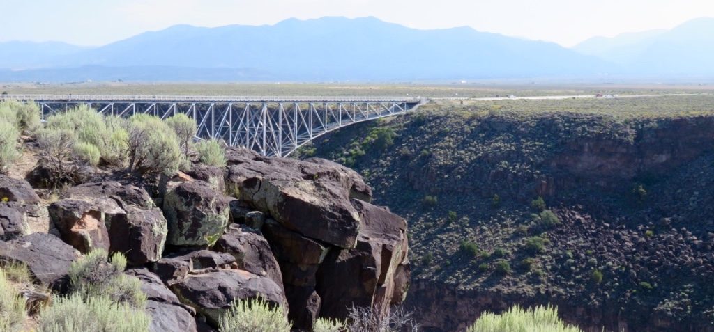
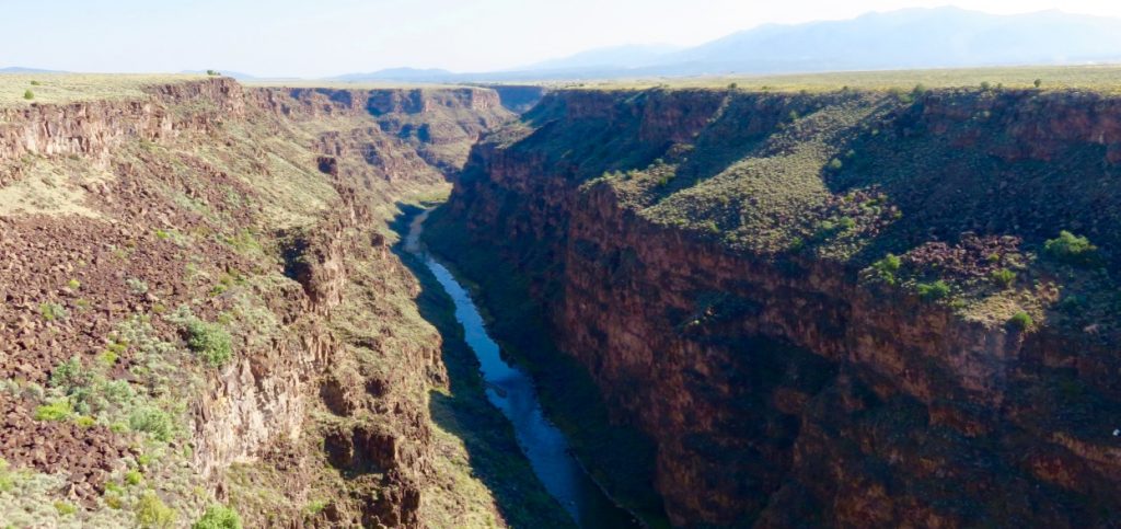
Rio Grande Gorge and the Gorge Bridge
Rio Grande Gorge
The Rio Grande Gorge is a 1,300-foot-wide tectonic chasm in an otherwise flat, empty tableland in northern New Mexico. Here, the river flows through the Taos Plateau. Located ten miles west of Taos, the Rio Grande Gorge is the only major rift across an otherwise flat expanse of land between the Carson National Forest and the Sangre de Cristo Range.